[Abstract]
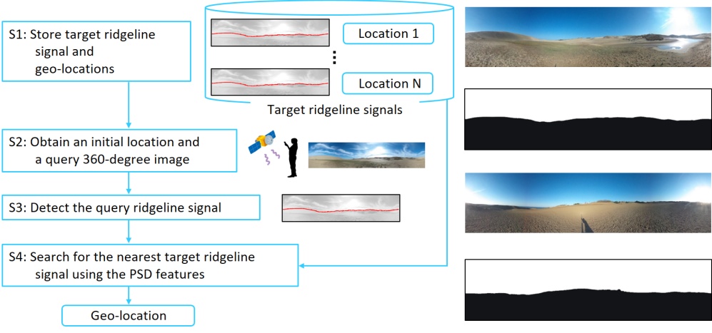
We propose a method to extract the features of sand-dune ridgelines using a 360-degree camera to improve the accuracy of estimating geo-locations. It is difficult to estimate geo-locations in an outdoor environment with almost no texture such as in sand dunes. We focus on the feature of the ridgeline, which is the boundary between the ground region and the sky region. A 360-degree camera can quickly detect the ridgeline signal in all directions in a sand dune. Our method determines the current location by searching for the nearest ridgeline signal from target signals and pairing with their geo-locations. We evaluated the accuracy of this geo-localization method using synthesized images generated from a digital elevation model. We also evaluated it using real 360-degree images collected in sand dunes. We confirmed that our method significantly outperformed the existing geo-localization method on both synthesized and real images.
[Publication]
- Shogo Fukuda, Shintaro Nakatani, Masashi Nishiyama, Yoshio Iwai,
Geo-localization using Ridgeline Features Extracted from 360-degree Images of Sand Dunes, Proceedings of 15th International Joint Conference on Computer Vision, Imaging and Computer Graphics Theory and Applications (VISIGRAPP), Vol. 5: VISAPP, pp. 621 - 627, February 2020.
